Crucial Services
This business is listed in the surveyors Business Directory
-
Region: shropshire
Town: Oswestry/Croeswallt
https://crucialservices.net/
- Other Pages: Drone Surveying Services | Land Surveying Services | News
- Reliable spatial data is a crucial element of any successful project to design or maintain the built or natural environment.
If you need to precisely understand an environment we have the geomatic services to accurately measure, model and report that spatial information.
Crucial Services employ a range of Land Surveying, Photogrammetry and Drone services to efficiently gather and process your data in a cost-effective way.
Land Surveying services:
Topographical Surveys; Measured Building Surveys; Setting Out,
Volume Calculations, Deformation Monitoring, Modelling
Drone surveys:
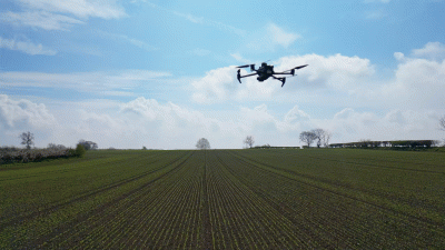
Drone Mapping; Inspection Reports; Crop Surveys; Progress Monitoring;
Volume Calculation; Modelling; Videography and Photography -
Crucial Services Is Also Listed In:
surveyors in Oswestry/Croeswallt
Shropshire Business Directory
Oswestry/Croeswallt Business Directory
surveyors in shropshire
surveyors Directory
